Google Maps is usually used for fun or exploring new places, but what if a simple satellite image could solve the mystery of a person who went missing years ago? This heartbreaking story reveals how technology, specifically Google Maps, uncovered the tragic fate of a man lost for a decade. Don’t miss this jaw-dropping tale of how the tool we use daily played a pivotal role in solving an unsolved case!
How Google Maps Solved the Tragic Mystery of a Missing Man’s Death After 10 Years

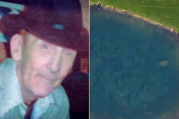
In 2006, 72-year-old David Lee Niles, who was living in the United States, was reported missing by his family.

That day, Niles had said goodbye to a friend at a bar and then suddenly disappeared.
Niles, who had been battling cancer and dealing with mental health issues, left his family deeply shaken.

With no clues as to his whereabouts, he gradually faded from memory. In 2011, his family, feeling helpless, published an obituary and accepted his loss. The family wrote, 'Only God knows where and when he died,' believing that Niles was no longer alive.
Then, in 2015, nine years later, events took an unexpected turn.
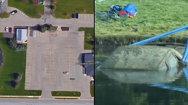
Brian Houseman, who was decorating a Christmas tree at Cook Funeral Home, noticed something strange in the distance. As he climbed up to get a better angle, he thought he saw a car in the pond. However, due to the murkiness of the water, the object had never been noticed before.
Houseman reported the sighting to the authorities, and the Kent County Sheriff's Department quickly took action.
Interestingly, when Google Maps satellite images were checked, the car in the pond was clearly visible.
A diving team soon arrived and retrieved the car from the water.
Inside the vehicle, they found Niles' remains and his wallet. This tragic discovery gave his family some closure, though the mystery behind Niles' disappearance has still not been fully solved.

